The Big Land - Southern Labrador
I believe it to be true that there are not many borders where one might transit a time zone and move clocks ahead by one and a half hours. But quite honestly I really was never sure what time it was while I was in Labrador. Parts of Labrador adopt Newfoundland time, which is one half hour ahead of Atlantic time (eg Nova Scotia), parts are on Atlantic time, which drops back that half hour. Blanc-Sablon, Quebec, where the Bella Desgagnés docked and from which the ferry for Newfoundland would depart, was way back on Eastern time like the rest of Quebec. All this is due to the fact that until relatively recently this was a separate nation, not a part of Canada at all, and could decide for itself its time zone. It chose a half hour off from everyone else, though in practice every community seems to adopt whatever makes most sense for them. This is a land for which the standardization of time zones, largely created to run trains across continents, has had little impact.
My phone’s clock kept moving back and forth depending on from where the signal was coming. And the ferry between Newfoundland and Labrador (technically it departs from Quebec only a couple of miles back to the west) seems to set its schedule by Newfoundland time, even when sailing from the north, which could be interpreted as either a half hour or an hour and half ahead, I think. Not sure. In truth, I never knew. As a result, and due to me not bringing a real watch, I couldn’t tell when anything was supposed to happen.
Fortunately, very little actually was supposed to happen. Virtually everything other than the ferry was still closed for the season. Which wouldn’t have been much anyway. There isn’t much there other than things needed for life, like hardware. The sum total of Labradorian establishments I patronized was a single gas station with a convenience store inside, though I did pass up a stand selling chicken that was open.
At the end of the last post from this trip, see Côte-Nord, I was heading off into Labrador without a plan. That is not entirely true. My plan was never to spend much time there. Labrador is a huge place. Unless you give it a lot of time you can barely scratch the surface. You can see in one day’s drive about the same thing that three or four days will still be showing you. It’s amazing stuff, but it morphs slowly. My real Labrador trip is still in the future, sailing up the northern Labrador coast, using yet another cargo ship serving more roadless villages. This trip would only provide a small sample. It was iceberg season in Newfoundland and that was drawing me south pretty quickly.
Still, I wanted to drive east along the southern coast, before the road turned north and became lost in the Canadian tiaga. At that point the road would travel a very long way before the Labrador Sea could be sighted again. I drove to the point were warning signs said that road closures might be expected. Uncharacteristically, I heeded these.
Fun fact. The tiaga that stretches across Canada, Alaska, Siberia and Scandinavia is the worlds largest land biome. It goes on forever. But one actually can drive all the way to where I stood, taking the Trans Labrador Highway, only about half of which is paved. It first heads north past the site of an ancient meteor strike, quite visible on even the space perspective on google earth, it is that large. (It’s currently represented by a large circular lake with a circular island in the middle, you actually have to zoom out into space enough to see what it is.) And then the TLH turns east and then south again to where I was at this point. That’s around a thousand miles with only a few towns or settlements. They give you a satellite phone when you get on the road. You give it back at the other end. As I said, that’s for a future trip.
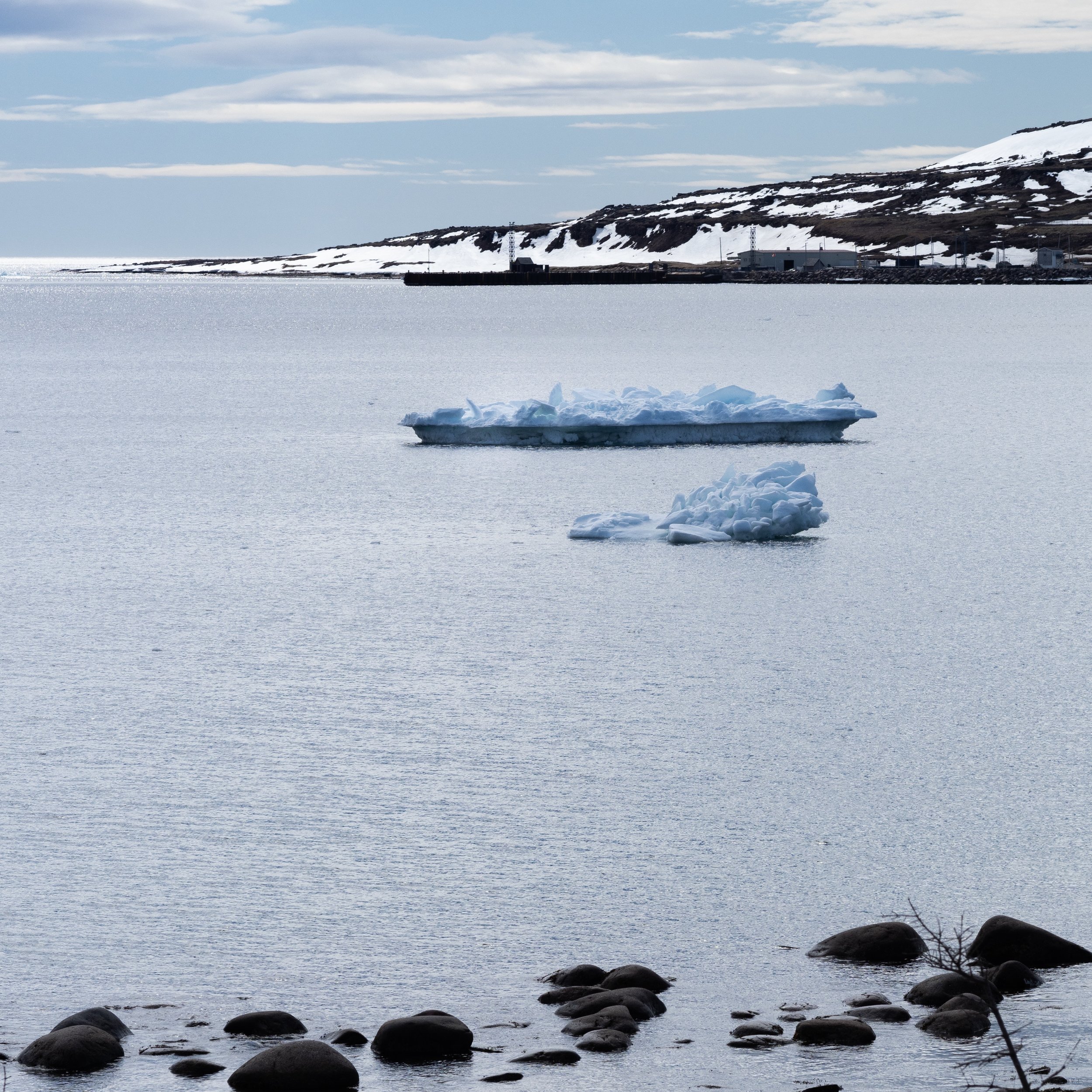
So what is southern Labrador like? There wasn’t much ice in the ocean when we arrived. We had just been subjected to gale force winds out the west for four solid days, which then funneled into and through the Strait of Belle Isle between Labrador and Newfoundland, only 15 miles across at its narrowest point. Most sea ice that hadn’t been stuck in harbors and bays along the Côte-Nord had been blasted out into the Newfoundland Sea where a northern wind was pushing south towards the northeastern coast of Newfoundland. All that sea ice, along with icebergs from Greenland, were piling up there. Labrador was, in sailors’ terms the “weather shore.”
In parts the land was reasonably flat, but in in many places the highway climbs over and dips back down from flat topped mountains that also protrude into the sea, creating bays. Aside from the conifers shown above, I don’t think there are many trees that are higher than 4 feet. It is a land full of NYC apartment sized Christmas trees, though they are probably a hundred years old each.
After I was satisfied that I would have to drive another 500 miles before I saw anything that would be much different, I backtracked to Blanc-Sablon and eventually crossed over to Newfoundland by ferry. This is where the ice was landing, and through which the ferry had to hammer a passage several times a day.
From here, I head south through Newfoundland.
©️ 2019 D Abbott