Dead landscapes - the wild/farms of Maine’s Allagash
This series of posts, of which this is the first, is not just going to be a simple account of some wild landscapes I’ve seen and, more recently, begun to photograph. I did thoroughly enjoy them and they did feel wild as experienced, crazy wild in fact. But each of these I have selected because, wild as they may appear to us, they were created, moulded and ultimately sustained by the hand of Man. (Let’s be honest, probably more man than woman.) That is a travel story worth exploring too, though much harder to unravel than just flipping through pictures after you return home. And so, that is what this series will be dedicated to: wilderness that really isn’t. The attention grabbing main series title, Dead landscapes, is perhaps a bit of hyperbole, but maybe not quite always. That too can be just a matter of perspective that needs to be unpacked. We will see as we go.
Part One: The Allagash - The Maine Woods
In 1971, the year I graduated High School, my Dad took my younger brother and me, along with about 4 more canoe-fulls of our cousins, on a week long trip down the then recently Federally “protected” Allagash Wilderness Waterway in Maine. I believe the Allagash was the first such wilderness waterway ever established; environmental policy was breaking new ground.

Allagash Falls, courtesy of Bryan Abbott
This was a heady time for setting aside lands under Federal protection. Battles were hard fought and not always won. Our family followed these wars with keen interest, falling squarely on the side of preservation, or the word mostly used then was conservation, which eventually got a bad rap when the BLM and Army Corp of Engineers started using it.
We even embarked on a Great American Road Trip out to the arid deserts of the Great Basin in 1964. Our AC lacking station wagon was packed with camping gear and 4 seatbeltless, hot and cranky kids. We were there to see pink sandstone arches and canyons in southern Utah before the waters of Lake Powell, rising inexorably behind the just completed Glen Canyon Dam, would cover them for a century or or two, or more, maybe forever.
[In today’s municipal publicity materials for nearby Page AZ we are informed that until the Glen Canyon Dam and it’s reservoir were built, one had to actually walk many miles over rugged terrain to see the marvels that can now be seen from the comfort of a tour boat; they don’t mention all the stunningly beautiful but now lost box and slot canyons that the boat glides over to get there (Tad Nichols) thanks to our parents we saw at least some of them.]
But on a personal family level, the 1971 Maine river trip, though in honor of the newly granted status for this area, simply was an extraordinarily generous thing for Dad to do. He took on all that responsibility over all these kids, to say nothing of the work involved. And it gave rise to memories and family stories that still get told, almost 50 years since.
I recall moments with a clarity that few other things from those years still share. Such as drifting down a relatively quiet, while swiftly moving, stretch of river and coming around a bend to see my 19 year old cousin, Dallas, standing erect, proud and unpanicked, still clutching her cedar canoe paddle, but stranded mid-river on a rock maybe only a couple of feet wide and protruding just a few inches above the surface. The last time I had seen her she was in the bow of Dad’s canoe. He was a negligent canoeist. She was retrieved by someone, Dad had long since been forced downstream.
Or the time above Allagash Falls when Dad and I figured we should run the pretty significant rapids (I had never, and still have not, taken a canoe down bigger rapids) from the safety of the portage take-out right up to the point where the river disappears over the edge, all just to save us from having to carry the canoe maybe a hundred yards to that evening’s camp at the falls. I still can remember practically every rock and channel we slid down on our way to avoid disaster. Which we did. What I never was to know was whether his expression was delight or terror, since he was in front. I like to think he was having a good time. But he might have been wondering if he had raised an idiot, to which the answer is obvious.
And then, that 1971 trip directly led to a pack of our cousins returning to the Allagash many years later in 2013 to share this experience with two new generations. This may be something that 40 or 50 years from now these kids will be writing about in their blogs as well, roughly a century after our first family trip. And in turn perhaps they will be guiding still more generations of family down these lakes and a river. This is an unchanging place where continuity becomes real.

Round Pond, courtesy of Bryan Abbott. I recall being out exactly where they were in the photo, but in the middle of the night with a full moon and alone, till it dawned on me how stupid that was
The Allagash begins with a series of mostly man-enlarged, headwind infested lakes intended to provide water for sending logs downriver in spring melts. [One the last of the log drives had been run that year, the Clean Water Act of 1972 spelled their end and by 1976 the State of Maine had banned them outright; we saw plenty of evidence of them still, including one log boom behind which countless logs still floated, waiting to be led downstream or more likely trucked away.] The river then flows out from these lakes through an outlet to the north.
The river marks a 60 mile long thin blue line across the upper half of the map of Maine. After beginning in those lakes just west of Mt Katahdin the waterway runs for a total of almost 100 miles, ending close by the Canadian border, where it joins with the St John River on its own path defining the wiggly part of the northern border of Maine. Eventually, in New Brunswick, the combined waters mix with the ocean tides in the Gulf of Maine.

To canoe the Allagash is to travel through the storied North Maine Woods. A wilderness where glass-still lakes will be viewed through a water hugging morning mist and mountains in the distance. There will be approaching thunderstorms flashing lightening which then, by counting in 5 seconds per mile increments to the thunderclap, will warn when to head to shore for shelter. Fresh and vigorous rapids will hide canoe killing rocks just inches below the fast moving surface. Tents will be pitched and meals cooked, eaten and cleaned up right by the lakes, rapids or waterfalls. You can read a still nearly accurate travelogue in Henry David Thoreau’s descriptions in The Maine Woods, written about 100 years previous to our trip. And you can experience the local populations of moose, possibly some bear, native brook trout, black flies, noseeums, and cranky old profanity-spitting wool-clad river guides in bateaux, not canoes, using a pole and line to work down the rapids rather than the modern paddle. (Okay, we didn’t see much of that last one.) The Allagash was a wonderful thing to do and it lived up to everything just described - other than that profane guide thing...
And yet, it‘s kind of a fraud to call this a wilderness. (Note, rant begins here.)

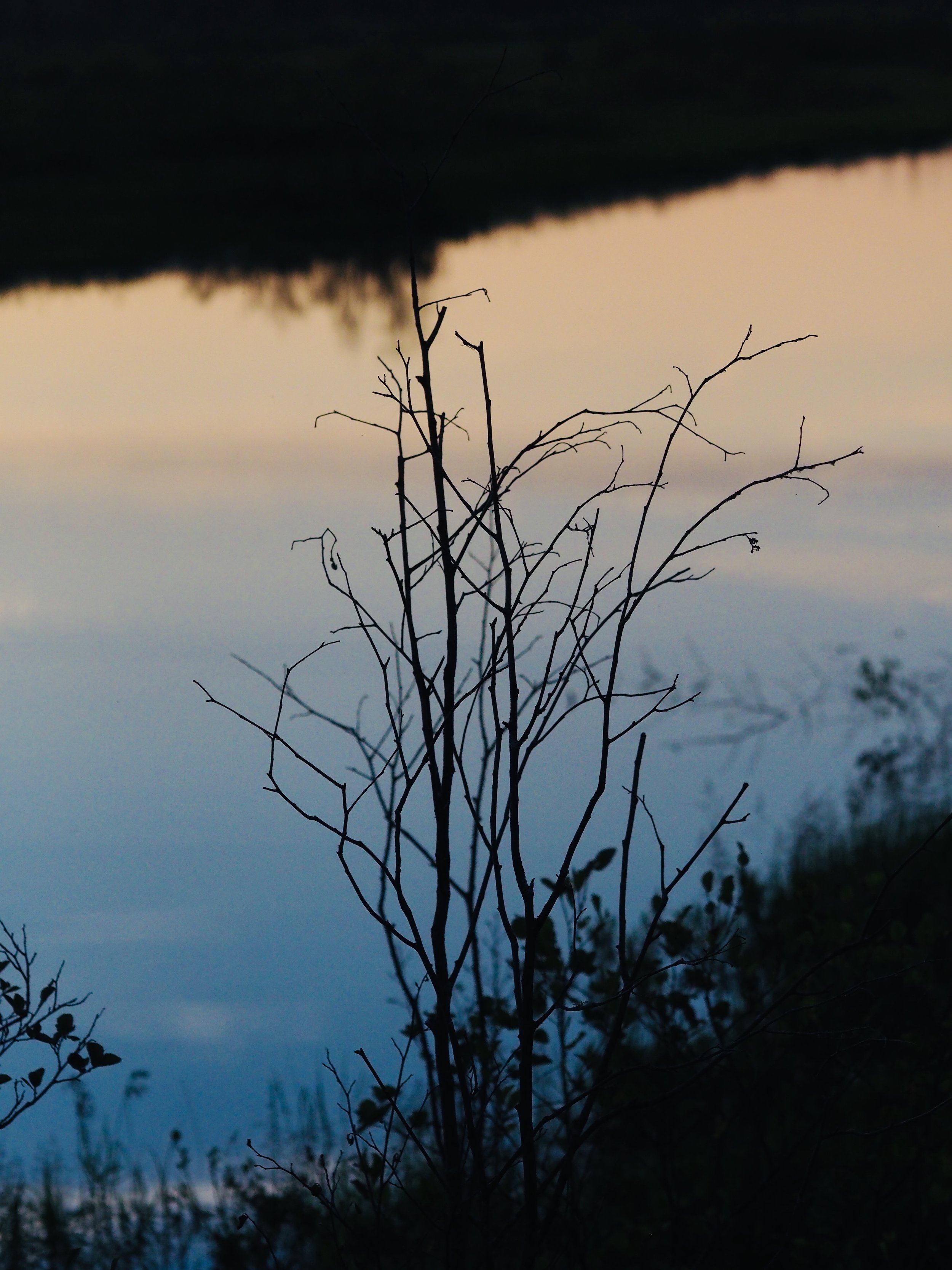
Moose (yep, I really did just label this shot moose)
As seen from the water, it is a green and wild land. Moose really do venture down and cross your path as you paddle by. That green and wild however is probably only a few hundred yards deep, if that. Outside of this slight strip of land along the river and the lakes, invisible to the visitor who is bound to the water, are the operations of privately owned logging companies.
This is nothing new really. Thoreau himself described the remnants of logging activities seen in his own travels here. Logging has been a driver of the Maine economy since the early to mid 19th century. Bangor was once the largest lumber shipping port in the world. But what does logging mean for today’s north Maine woods?
Here is a representative screen shot of a portion of the river taken from Google Earth. I have converted it to black and white to better see the contrasts.

The lighter areas in the picture show forest that has been cut, the timber removed. Only the darker areas represent uncut forests. Most people, I think, will look at this picture in shock and perhaps pronounce those lighter, treeless tracts, a dead landscape. This is not what they expect from a wilderness. But I swear, going down this river one would never know.
I am not intending to start a big debate here over the logging companies of northern Maine. But, I didnt see the situation as many environmentalists do, “cutting trees is bad, anyone that does that is bad - full stop.” I figured we have to balance the desire to see forests growing, as yet uncut, with the fact that a vast tract of northern Maine, an astounding number of square miles, has been encouraged to stay wild enough to keep on growing healthy, tall trees and not been taken over by other land use practices which I would object to far more. Maine is after all the most forested state in the Union; it probably hasn’t always won in that category but it does now.
You will note that in that Google Earth shot there are no strip malls, fields of monoculture corn being used to make sweeteners or ethanol, or endless asphalt highways passing the chain hung mailboxes of vacation homes up rocky drives.

Courtesy of Bryan Abbott
I was, and remain, 100% sure that not always are the best ecological practices being followed. I haven’t the knowledge or experience to pass judgement on what is being done or could be done better. Probably a lot better. And I hope they can be encouraged to always do so.
But, this past summer I spent a couple of evenings driving out onto rough, boulder strewn, spine compressing, tire shredding northern Maine logging roads to the east of Moosehead Lake. I was there to see more of Maine than just the coasts I had grown up with.
I wanted to view a clear cut area up close, getting out of my 4WD and even walking into it. I drove miles down these “roads” shown on no maps or GPS App, until I had passed by massive machines; just their tires made my car look small. These Transformer-like behemoths will cut and clean the huge tree trunks as if mere toothpicks.
I was in land that was actively being logged by day, but I was there in the failing light of evening. They were quiet now, their operators knew enough to go home when the sun got low. Somewhat stupidly I passed right by the posted warning signs. There would be no cell phone service out here. No one knew I was even there. A flat tire would be a real pain, a broken car would mean spending a night with a long walk out in the morning.

I have no pictures unfortunately, other than this one above taken in an area that had been cleared (or burned, I am not sure, it was hard to tell the difference, and I have no idea for how long) but trees were growing back. True, the light was failing, but mainly it just didn’t occur to me then that anyone would want to see any of this. Landscape photos that we want to take and then share tend to be majestic and pretty, not these.
I stopped at what looked like a representative clear cut lot. Dead tree remnants and their mangled limbs and parts were scattered everywhere, pointing grotesquely in every direction. This was indeed a shocking, perspective-shifting landscape. As if in a great melee, the trees from the hillside had battled to the death with those from the creek bottom. One imagines the Somme might have looked like this in 1916, only after a really pretty, bright sunny day.
But still, I also was looking at a massive amount of green debris, called “slash” in industry jargon. That slash will encourage regrowth, provide soils with shade and protection, secure and feed soils with decaying roots, and prevent erosion. The trunks are mechanically stripped of all other living, organic material which is left right where it had been growing. The only time slash is removed is when it poses a fire danger (such as under a power line) or is near a highway or a waterway that could suffer adverse water quality impacts. They then have to pay someone to go and take it out.
I have become a gardener, something I now share with Dad’s memory, but I am the really irritating kind that practices permaculture. That means I find ways that use or at least mimic nature rather than relying on reductionist recipes for success; compost over fertilizer for instance, mulch over pulling weeds. See Permaculture. One of my guiding garden principles is that “nature never tills,” and so neither do I. That would make a nice t-shirt, yes? See no-till
After the shock of the violence of the place subsided, this clear cut area full of death began to look to me like something else, more benign and perhaps even familiar. It looked like a really big garden after harvest or the cropping of a green manure. See green manure. This was an ice giant’s garden from Norse mythology (or Harry Potter or Game of Thrones or at the end of Jack’s Beanstalk) with beds of monstrously huge vegetables, all tended while practicing no-till gardening. After the crops were removed there still were roots in place and bark, sticks and branches too. Whole branches as thick at least as Arnold Schwarzenegger’s thighs.
Loggers may call it slash, but the ice giant will just call it by it’s gardening name, wood chip mulch. Lots of mulch, really really big wood chip mulch. And all the smaller stuff too. And like the wood chip mulch in my own garden, this was going to be the key to good soils and future years’ healthy, strong plants.
It was possible that I simply had stumbled onto the only ice giant no-till-garden-method logging company in the entirety of Maine. So just to be sure that I was not simply seeing some outlier and making an obvious mistake, I read up on Maine’s State forestry regulations.
Whether regulated or unregulated back in 1971, probably “un”, it’s worthwhile to note that currently just a summary of these rules and regulations in a “practical guide” is over 100 pages long. (Maine Forestry) That guide summarizes required practices for differing categories of lands, more stringent for example when located within an organized town limit. But the state-wide rules on clear cuts were what I wanted to review. Were the limits on this activity designed to preserve the ability of the land to recover? To grow yet another generation of trees and forest?
Though I have no expertise to guage the actual effectiveness of these rules (spending an evening driving amongst the clear cut fields does not make me an expert) I was impressed that they did seem to target a sustainable methodology. They reminded me of Maine’s other major industry, and the size, sex and location rules by which its practitioners abide, lobstering. (Did he just say regulated lobster sex?)
The reader can go and look at the forestry regulations for themselves, a cite is included above, but what I found were stated limits for the size of a clear cut field, requirements for significant barrier strips beteeen them so that there would remain forested areas to help regenerate the forest, and requirements for maintaining those strips for a period sufficient to allow them to do their job.
Go back and look at the Google Earth screenshot and notice that the lighter areas all are surrounded by rings of darker land, that is where the forest strips were left, as a barrier between clear cut lots. Maybe this is sufficient, maybe not. But simple, voracious and indiscriminate exploitation it is not.
Logging rules may not be the same everywhere. For instance, I’ve read, without confirmation, that in “live free or die” New Hampshire these rules are somewhat more relaxed, though land owners still need to keep a tree line buffer along roads, lakes and rivers for asthetic reasons. (Thanks Allagash!)
I don’t know about logging in the American West, the tropics or anywhere else. This is a travel blog not an environmental or logging industry think tank publication. I am just expressing the value of making your way to places to see for yourself what is going on there and then maybe thinking about it.
But I see no reason to assume that all logging operations are the same and that all logging environments pose the same problems. My mid-Atlantic, temperate climate, diversely planted, heirloom seeded and almost never watered garden at home may present a very different set of environmental issues than a monoculture, hybrid seeded, 1,000 acre, fertilizer-jacked, chemically pest and weed suppressed farm in a well-water irrigated field in a much drier climate. I am capable of drawing the necessary distinctions there, and we should for logging as well.
So it occured to me that maybe this particular field, and by extension maybe those now abutting the Allagash, had been no more damaged long term by the logging than my front and back yard gardens are after an Autumn harvest and a winter cover of new wood chips. Just a lot bigger, and over a much longer timescale. I came away from this landscape asking whether these “logging” companies are really in the business of cutting trees, any more than a farmer is in the business of cutting wheat, beans, carrots, tomatoes or corn. Maybe they, like farmers of normal crops, are in the business of growing trees.
So those evening drives, stupid as they were, got me to rethinking the Allagash. The Google Earth map shown here sends a powerful message of a hidden-from-view land that seemingly has been killed, destroyed by monster machines. I had come to the Maine woods unenthusiastically thinking that logging maybe was a necessary evil, it kept land mostly forested. But I assumed it would come at a brutal cost. I did not think actually seeing a clear cut would be very pleasant or that I would come away thinking it had any positive message.
But, actually going to a place can make a difference. And though the title of this series of posts uses the arresting phrase “dead landscapes,” and the immediate impact of seeing a clear cut field was shocking, I also saw, unexpectedly, that these clear cut fields are not dead. Anything but. The death was transitory, as all death in nature is. They are full of rebirth, the very essence of life.
But they also are not really a wilderness.
In the case of the “Allagash Wilderness Waterway,” though a far cry from the “lazy river” at your local water park, it still is a managed landscape. It is to wilderness what a sheet of veneer is to a solid block of hardwood. It provides a wilderness aspect on the outside surface, but mainly, logging notwithstanding, keeps nature chugging along with clean water, enough biodiversity and the good and protected-with-mulch soils needed to support the ongoing growth of a very large, largely unbounded and healthy forest.
And a nice trip down the river too.

Long Lake Dam, courtesy of Bryan Abbott
We should come here and then canoe away realizing just what this is. Persevering in our minds an illusion of pure wilderness (or pure farm) maybe isn't exactly a good thing.
Altogether, this is a “wild/farm” (my term) which happens to be growing commercial crops of the middle portions of wild tree trunks, using wild techniques, giving habitat to wild creatures which in turn play their own roles here, directly returning what is not actually harvested back to the soil to compost where it had grown, and relying on nature to do all the really heavy lifting. That is the essence of permaculture. Its wild/farm nature cannot be understood in timescales shorter than four or five decades, not just over a single growing season, and that itself is a wonder to experience. And the land is probably better because of being wild/farmed than had it just been land available to use in many other ways.
In a retelling of It’s a Wonderful Life for the logging companies, that slender line of trees would be angel-transformed into motor boat accessorized holiday homes lining the shores of the lakes and summer cabins along the rivers, all on 50 foot wide, fenced lots. Pesticide/herbicide infused and fertilizer accelerated grass lawns would replace fallen pine, cedar and fir needles on the ground. There would be towns, roads, fast food and gas stations. The bars would become unruly. (bars?) Lumberjacks would go unrecognized and be shunned.
By movie’s end we will be rejoicing that logging had not disappeared after all. For he’s a jolly good fellow might be sung for the now smiling, children holding lumberjacks. The Allagash is beautiful once more.

Below Allagash Falls, courtesy Bryan Abbott
In short, without this land being held by logging companies, by 1971 there may not have been anything left here to designate as a Wilderness Waterway at all. And even though every inch of this land had been logged, right up to the river even, it still looked and felt like a wilderness.
When I think of those places where we should maintain current land use practices wholly intact, I guess I will take the wild/farms of the Allagash, fields ashamedly hidden from sight, over the sprawling suburbs of most American cities.
Even though it isn’t a wilderness.

August 1971, back in Harpswell on the Maine coast, right after we returned from the Allagash
Thank you Dad
A note on photographs, I had taken with me down the Allagash a very nice German camera, which I had bought in Ireland a couple of years before in 1969. It had a German lens in it and I think it was probably made by Zeiss. But not sure, lost in memory. This was a time before names like Zeiss and Lecia had become fully legendary, Germany was still trying to rebuild its industries, some of this technology and machinery were in the hands of the Soviets, and so a camera like this was within the grasp of even an ignorant American kid like me in a Dublin camera shop. I do recall the picture quality and colors being outstanding, far above what my prior camera had shot and frankly better than any other camera I would own for a long time after.
In any event, in our first real rapids, Chase Rips, I went first and promptly flipped the canoe, sending nice German camera into the drink. I fished it out but that was that. Wholly ruined. So for my own photographs I am showing here a couple of representative shots that I took in northern Maine in my travels there this past summer. But I think they stand in pretty well. And this isn’t a photojournalism forum after all.
However, several photographs are from my brother taken on the second family trip down the Alllagash, and those are attributed to him. With just a little overlap, Dallas (to find that mid-stream rock again) and Bryan, three generations of cousins were given this same experience, largely unchanged, that we enjoyed almost 50 years ago.
©️ 2019 D Abbott